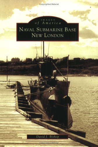
 I found this nifty little book at Walden last spring, and grabbed it immediately. It's part of the Images of America series published by Arcadia, and follows their standard format - a small book (128 pages) full of historic photos (I counted 180, plus several drawings) of the area in question. The author is a former curator of the Submarine Force Library and Museum, and he used pictures from both the museum's archives and his own collection.
One good point about this book is that it includes something that other books from this series I've seen don't include - maps. At the front is a reproduction of part of an 1868 map showing the Naval Yard (bisected by the Ledyard and Groton town lines), and scattered throughout the book are five more maps, drawn by the author: 1868, 1915, 1919, 1944 and 1988. These two-page maps are all drawn to the same scale and cover the same area, so it is easy to compare them and see how the base grew over the first twelve decades of its existence.
Commodore Timothy Hunt was the first commandant of the Navy Yard, taking charge on 19 Jul 1868. The base had 26 more commanding officers over the next 47 years, ranging from a rear admiral down to lieutenants, chief petty officers, and even a pay clerk.
The first section of the book shows some of the houses that used to stand inside the area now covered by the base. My favourite from this section is a 1941 photo showing the south end of building 83 (originally SubScol student barracks, and now the PSD building), with the boundary fence running a few yards away from it and a house and yard where the Thrift Shop car park is now.
Then come pictures of the early days at the New London Navy Yard - including a picture of the Navy's first battleship, USS Texas, moored alongside to load coal in July, 1900. The Navy Yard became a sbmarine base (commanded by Cdr Yates Stirling) in June, 1916, and an order issued in September of that year established a complement of 76 men whose duties were to "assist submarines in routine repairs and to perform such jobs of construction and remodeling on the base proper as were within its scope."
The base grew considerably during World War I, and crossed the State Highway (now Shark Boulevard) to include a strip of land on the east side of the road. The old T-shaped wharf was replaced with individual piers, and the 81 new buildings included the power plant, a rather nice-looking student officers' quarters (on the site of the current gym), and a stable and water tower (where the BOQ is now). In those days SubScol was located in Building 3, which sported large porches running the length of both floors.
Photos from the '30s include the conversion of USS O-12 (SS 73) into a strange-looking vessel called the Nautilus, to be used for Sir Hubert Wilkins' attempt at reaching the North Pole. There are also pictures showing the old escape trainer in use. (It was already closed, alas, by the time I went through BESS in '82.) My favourites from this section, though, are the photos showing the hurricane of 1938 and its aftermath; one shows two boats tied up to a completely submerged pier (Pier 6, IIRC), with their mooring lines disappearing down into the water, while another shows Building 1 with its roof blown off.
The base expanded once again during World War II, of course. New construction during the war included the base theatre, the gym/drill hall, the swimming pool, the Chapel on the Thames, a big new mess hall (on the site now occupied by Bledsoe Hall), and a new hospital (Building 86, now used by Navy Legal). There are interesting photos showing construction of all of these, as well as the boats and other things. Somewhere along the way, between 1919 and 1944, Crystal Lake was filled in and replaced by a tank farm. (The ball fields and package store are there now.) And did you know that Building 161 (next to the Susse Chalet; now, I believe, the Restricted barracks) was originally built as a WAVES barracks?
Post-war construction included a new waterfront. North of the Milkstand parking lot, the railroad tracks used to run right along the riverbank. A large area of river was filled in, and new finger piers were built to support the 16th Reserve Fleet; one aerial photo shows 46 boats laid up along the piers, which reached from the dry dock's berth up to "Pier Norwich."
There have been plenty of other new buildings put up since the war, of course. The new Exchange and Commissary (where the mine depot used to be), the new hospital and other buildings up on the hill, and of course the new library and museum outside the gate. The last photo in the book shows the new, Nautilus-shaped "Submarine Capital of the World" sign which was put up on the south side of I-95 in 2004.
All in all, I found this book fascinating, and I would recommend it for anyone who is interested in the history of the US submarine force.


1 comment:
Hi RM1(SS)Just saw your blog and want to thank you for the kind words you wrote about the book I wrote on the Sub Base. Not sure if I may have met you while we were both there. I retired from the Base in December 1997 and had 26 great and interesting years working there as a civil service employee. I'm especially pleased that I was able to turn my knowledge of the Base into a book for all to share. Best wishes, Dave Bishop, Mystic, CT
Post a Comment